| |
Weg der Schweiz
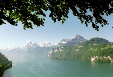
This attractive route runs around the southern part of
Vierwaldstaettersee, the "Urnersee". As a present to the 700 anniversary
of the founding of Switzerland all the Cantons participated in the preparation
of the route. Each Canton was assigned a part of the whole route (a certain
length per habitant) and the order was according to the time when that Canton
joined the federation. Start of the route is on Ruetli, End is at
Brunnen. Total
length is about 35 km. There are a couple of brochure's available
containing more or less detailed maps. Along the route are many resting
places, access to public transport and interesting explanations.
Fluelen is quite an interesting place, as a tourist region, as the most southern
ship station of the Vierwaldstaetterseee, as the gate to the Gotthard, as base
for the Windsurfers, as railway station. The trip by ship to Luzern takes about
3 hours.
 |
Brunnen to Fluelen: I
find this part of the "Weg der Schweiz" very attractive - and by train
it's only about half an hour from Zug to Brunnen which is a very popular tourist
small town. |
|
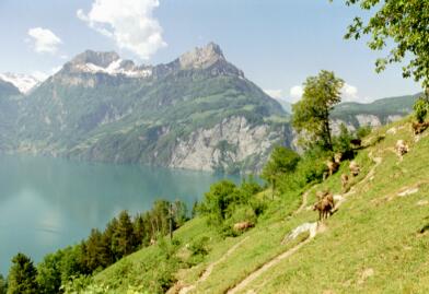
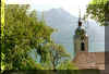
Seelisberg
to Fluelen: A ferry boat brings you from Brunnen to Treib.
Here by a funicular you reach the lovely village Seelisberg. The track
down to Bauen will have hundreds of stairs, so be warned.
Seelisberg has a lot to offer: many walking tracks and of course its
well known alpine lake.
|
 |
Sign for "Weg der Schweiz" |
|
 |
Urnersee, Seelisberg |
| Brunnen-Sisikon-Tellsplatte. |
km |
Hrs |
| Zug - Brunnen (train) |
|
|
Brunnen-Kloster Ingenbohl- (Chaenzeli)-
Gruobi-Axenfels-Morschach-
Sisikon-Tellsplatte/Tellskapelle |
12 |
3.5 |
| Tellsplatte-Fluelen |
5 |
1.5 |
| Fluelen-Zug (train) |
|
|
Arriving from Zug we can see the first
part of the walk, the big monastery on the left side on the hill, the "Kloster Ingenbohl". Further general direction is "Morschach,
Axenfels". The route is ascending, first on Bitumen road, later on gravel road. For the most part
we can walk in the forest. If you
want to shoot a pretty picture then the detour to "Chaenzeli" is worth
the additional 20 Minutes return. The path is ascending to shelter Gruobi.
After a while we reach tourist resort "Axenfels" with the well
known Sport hotel (www.swissholidaypark.ch). On the way
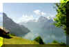
to Morschach and on to Sisikon we have fantastic views into the nearby mountains. Gitschen and
Urirotstock on the other side of the lake and Ober - and Niederbauen are
dominant. Fronalpstock on our left is quite impressive. The last part to Sisikon is a bit steep, but here again there
are great views.
|
 |
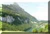
On the road Morschach-Sisikon.
Bauenstoecke |
 |
Morschach-Sisikon,
Gitschen |
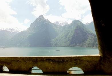
From Sisikon to Tellsplatte/Tellskapelle we are always near the lake and there
are some idyllic resting places with the possibility to cool off our feet. At
Tellsplatte there is a small Restaurant (self service) right at the jetty. If
you want a larger selection of food and drink you have to walk up to the main road for the larger
Restaurant on noisy Axenstrasse. You shouldn't miss the walk to Tellskapelle (15
Minutes return).
From Tellsplatte you may get aboard a ship and return to Brunnen or other places. If you are
still fit, we could go on to Fluelen. It's another 1.5 hour's walk with some ups and
downs (some staircases). The road is partly on the old main road (Axenstrasse),
partly right along the railway track, partly directly along the lake. You get a good idea
about road engineering as well.
 |
On the old Axenstrasse,
Gitschen |
 |
On the old Axenstrasse,
Seedorf |
| Brunnen-Seelisberg-Flueelen |
km |
hrs |
| Zug-Flueelen (SBB) |
|
|
| Flueelen-Treib (Faehrschiff) |
|
|
| Treib-Seelisberg (Standseilbahn) |
|
|
Seelisberg-Beroldingen-Wissig-Bauen-
Isleten-Seedorf-(Schloss A Pro)-Flueelen |
17 |
4.5 |
| Flueelen-Zug (SBB) |
|
|
The "official" starting point for the "Weg der
Schweiz" is Ruetli. The track from there would lead up to Seelisberg.
The trip from Brunnen across the lake to "Treib" and from there
by funicular up to the holiday village is nevertheless something special.
If you rather skip the part Seelisberg - Bauen because of the
many stairs, here are two alternatives:
- by ship directly to Bauen
- from Seelisberg down to Ruetli and from there by ship to Bauen (the
course of the ship will be by the other lake side).
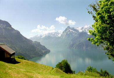
Seelisberg should not be missed.
Our hike at first will guide us through the holiday village with its
Hotels and Restaurants. More interesting though are the undisturbed
lookouts across the lake and into the mountains. At the former Grand Hotel
Sonnenberg a visit of the pilgrims chapel "Maria Sonnenberg is recommended.
The real trail begins at the post office. It leads into the forest and
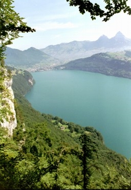
here too, we meet every now and then fascinating lookouts. Spectacular is
the view down to Ruetli.
 |
Below Ruetli,
in the distance Mythen |
After the forest path we reach a Bitumen road. It runs close to the
alpine lake.
 |
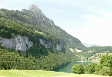
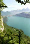
Pretty Seelisberg lake,
Oberbauenstock |
Now the road gets a bit steep but in a short while, after the
little castle Beroldingen the road is descending.
 |
Little Beroldingen castle |
Hikers appreciate the
fact that wherever possible, a stretch of gravel road was separated of
the Bitumen road. The Bitumen/gravel road ends at Wissig where Toilettes
and a shelter with tables and seats are provided.
From here the steep descent by lots of stairs down to Bauen begins. Here
too we're offered beautiful views. The good constructed path passes
forest and runs along bushes trees.
 |
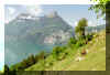
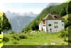
Bauen,
Fronalpstock,Rophaien |
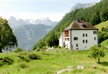
Bauen and its Restaurants are receiving us with open arms. The
picturesque scenery reminds to the Mediterranean. The casual atmosphere on
the beaches reminds to the school time vacations.
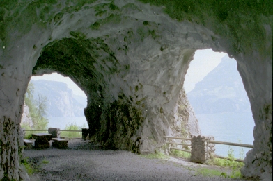
The part Bauen - Isleten is virtually flat, but the track is unique. It
consists of rock paths, caverns, galleries. In many places windows were
blown out of the rock walls, partly to let the light in, partly to have
fantastic views over the lake. In hot summer the hikers enjoy the nice
cool temperature.
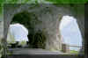 |
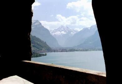
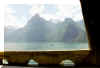
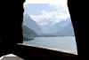
Tunnels and windows along the trail |
At Isleten we hit again a small beach and the track is flat and runs
directly along the lakeshore to Seedorf, again with a popular beach.
The leg Seedorf - Fluelen for the most part runs through a protected
area. Here too, there are only minor ascents and descents. Fluelen we
reach after crossing the bridge over the river Reuss and a detour around
sports fields, passing a lapidary enterprise.
|
Tellkapelle: Already in the 14th century a chapel was here.
Today's chapel is about 120 years old and was renovated for the 700 year
celebration . The
place is very romantic and the chapel is a national monument.
Legally
interesting: owner of the chapel and also the meadow on Ruetli
(where the actual
founding of the original Swiss federation took place), on the other side
of the lake, is the Swiss youth. The money was collected and then the
places were bought.
The paintings show
the most important scenes of 700 plus years back with Tell (our national hero,
as praised in Friedrich Schillers drama) and the founding of the Swiss
Federation. Actually, modern Switzerland was defined in 1848, with important
constitutional parts adapted from the USA. |
|